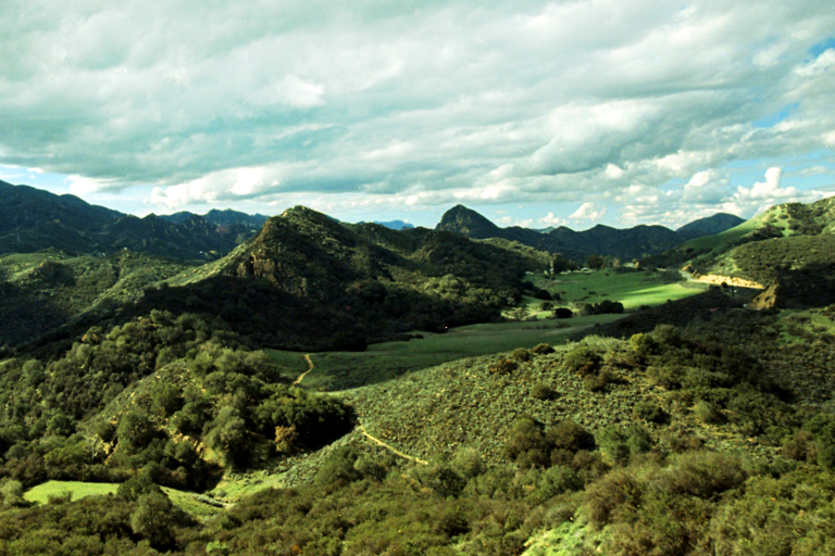
The Malibu Creek State Park is among the most popular outdoor hiking destinations in Southern California. Residents of Malibu, Thousand Oaks, and the greater Calabasas area are in close proximity to the many beautiful mountains, fantastic hiking trails, and exciting activities that can be found within the spacious Malibu Creek State Park. The park is spread out over 8,000 acres of savannas, plains, and gorges, providing you with a large variety of scenery for bird watching, fishing, horseback riding, and hiking. Because of the size of the park, there are a wide array of different hiking trails that you can visit when you want to spend time among nature. These trails differ substantially in difficulty, length, and features, which is why each one can provide you with an entirely new experience. The following is a comprehensive guide to 11 of the best hiking trails in and around the Malibu Creek State Park!
- 1. Malibu Lake Trail – 4.2/5⭐
- 2. Rock Pool and Century Lake Trails – 4.3/5⭐
- 3. Bulldog Loop Trail – 4.4/5⭐
- 4. Saddle Peak via Backbone Trail – 4.5/5⭐
- 5. Grasslands Trail – 4.5/5⭐
- 6. Castro Crest via Backbone Trail – 4.4/5⭐
- 7. Backbone Trail – 4.4/5⭐
- 8. Backbone Trail: Tapia to Kanan-Dume – 4.6/5⭐
- 9. Cistern Trail to Lookout Trail – 4.2/5⭐
- 10. Mesa Peak Trail – 4.5/5⭐
- 11. Crags Road to Century Lake – 4.1/5⭐
Looking for Thousand Oaks Hiking Trails? See our list of the top 10 Thousand Oaks Hiking Trails
1. Malibu Lake Trail – 4.2/5⭐
The Malibu Lake Trail is a somewhat lengthy trail that lasts for around 6.6 miles. Although the trail is listed as having a moderate difficulty, it’s also among the most popular hiking destinations in the Malibu Creek State Park, which means that there’s almost always a heavy amount of traffic. The main feature of this trail is the picturesque Malibu Lake, which marks the end of the trail and provides visitors with many beautiful spots for having a picnic or taking in the scenery. The start of the trail is located just off of Las Virgenes Road and Waycross Dr, which is also where you’ll find a large parking lot.
Keep in mind that horses are able to use the trail but dogs cannot. You’ll likely spot a large variety of wildflowers and will be walking right beside the Malibu Creek for most of the six miles. This map includes a highly detailed view of the trail. As is the case with all of the trails on this list, this hiking trail is open from dawn until dusk.
Malibu Lake Trail Trail Head
2. Rock Pool and Century Lake Trails – 4.3/5⭐
The Rock Pool and Century Lake Trails is a highly scenic loop trail that extends for around 4.5 miles. The trail itself offers an ample amount of shade due to the presence of many oak trees along the main path. Parking for this trail can be found at the Malibu Creek State Park Entrance on the second lot, which you can reach by traveling down Las Virgenes Rd. until you cross Mulholland Rd. Just outside of the parking lot is a sign that will point you towards the start of the trail. This is a very easy hike that is known primarily for its spectacular scenery and the various fun activities that you can partake in while hiking.
Stop at the Rock Pool to catch a glimpse of rock climbers ascending a wall where the first Planet of the Apes movie was filmed. When you want to relax and take a break from hiking, the Century Lake is a great place to stop for a picnic or for views of the nearby mountains This map should give you a good idea of what to expect when hiking these trails.
Rock Pool & Century Lake Trails Trail Head
3. Bulldog Loop Trail – 4.4/5⭐
The Bulldog Loop Trail is a loop trail that takes you through many different areas of the Malibu Creek State Park and lasts for nearly 15 miles. This is a difficult trail that reaches higher than 3,000 feet above sea level towards the middle of the hike and can be very steep. If you’re experienced with hiking, the Bulldog Loop Trail offers some of the best views in the park that will allow you to see for miles across Southern California. Since this is a loop trail, it begins and ends in the same location, which is located around one mile away from the main parking area at the entrance for the Malibu Creek State Park.
This entrance is located on Mulholland Highway and is clearly marked by signs. You’ll notice a large variety of wildflowers and the open plains situated beside portions of the trail. There aren’t many areas for shade along this trail, which is why it’s important that you take large amounts of water with you. Dogs are not allowed on any portion of the trail. This loop trail can be better viewed with this map.
Bulldog Loop Trail Head
4. Saddle Peak via Backbone Trail – 4.5/5⭐
The Saddle Peak via Backbone Trail is a somewhat difficult trail that takes you more than 2,000 feet above sea level. Given the steep nature of this climb, there are no dogs allowed on the trail. This trail extends in one direction for 4.2 miles before you turn around and walk the same distance on the way back. If you’re traveling to the trail from Las Virgenes Rd., the start of the trail is located on Piuma Rd. just after you pass the Cold Canyon Rd.
The best place for parking can be found around 100 feet after the start of the trail, which is where you’ll find a sizable dirt area that can be used for parking. The peak of the trail is located at the end of the four mile hike, providing you with gorgeous views of the Los Angeles Basin and many of the surrounding areas. A map of this trail and the path that it takes through the Malibu Creek State Park can be found here.
Saddle Peak via Backbone Trail Head
5. Grasslands Trail – 4.5/5⭐
The Grasslands Trail is the most popular trail on this list and is notable for being a great trail for all skill levels. This is a great trail to hike if you’re interested in visiting the M.A.S.H. site, which is where most of the famous TV show of the same name was filmed. The trail is an out and back one, which means that you travel back to the start of the trail on the same path that you took at the beginning.
There’s plenty of shade along the way as well as a variety of rivers and creeks that provide you with fantastic areas for taking pictures. Street parking is located right at the trailhead, which can be found on the left of Mulholland Highway shortly after you’ve turned off of Las Virgenes Rd. A detailed map of this 5-mile trail is viewable here.
Grasslands Trail Head
6. Castro Crest via Backbone Trail – 4.4/5⭐
The Castro Crest via Backbone Trail is a moderately difficult trail that lasts for over 10 miles and can be used for hiking, biking or horse riding. Dogs are also allowed on this trail as long as you make sure to keep them on a leash. Although there aren’t many trees along the path that the trail takes you on, the scenery you’re provided with allows you to see across large expanses of land in the distance with an elevated viewpoint.
The trail head is located right at the spot where the Las Virgenes Rd. becomes the Malibu Canyon Rd. To the right of the trail head is a spacious parking lot where you can safely park your car as you head out on the lengthy trail. Even though this trail can be a difficult one to hike, it becomes relatively easy and straightforward after the first couple of miles. This map will provide you with a closer look at the route that this trail takes.
Castro Crest via Backbone Trail Head
7. Backbone Trail – 4.4/5⭐
The Backbone Trail is a massive 63.2 mile trail that will take you from one side of Malibu to the other along your journey. Most people decide to break this trail up into sections, which means that you can get a different experience each time you hike it. You’ll see mountains, lakes, wildlife, and beautiful views of the ocean along your way.
If you’re searching for the highest peak within this trail, the Sandstone Peak can be found along the western section of the trail, which provides you with more than 3,000 feet of elevation. The trail starts right off the Pacific Coast Highway before you reach the La Jolla Canyon Trail. The end point is found just off of the Will Rogers State Park Rd. once you enter the Will Rogers State Historic Park. There are a variety of parking lots available to you every couple of miles along the trail. You can get a closer look at this 63-mile hiking trail by viewing this map.
Backbone Trail Head
8. Backbone Trail: Tapia to Kanan-Dume – 4.6/5⭐
Backbone Trail: Tapia to Kanan-Dume is among the most traveled sections of the Backbone Trail. It’s a 12 mile trail nearby Monte Nido, CA that’s considered to be easy to moderate in difficulty and comes with some breathtaking views along the way. The Tapia trailhead is located on Malibu Canyon Rd. with the Kanan trailhead being situated at the Kanan Dume rd. While a large portion of the trail takes you along open plains and savannas, there are also some shaded sections that can provide you with much needed relief from the sun.
The best parking spot is located at the Tapia trailhead entrance on Malibu Canyon Rd. The trail will take you to the top of a mountain around 2,900 feet above ground, which is a fantastic spot for taking pictures and enjoying the scenery. The full map for the Tapia to Kanan-Dume portion of the Backbone trail can be viewed here.
Backbone Trail: Tapia to Kanan-Dume Trail Head
9. Cistern Trail to Lookout Trail – 4.2/5⭐
The Cistern Trail to Lookout Trail is a well-traveled hiking route in the Malibu Creek State Park that provides visitors with easy hiking along a short 1.3 mile trail. The top of Lookout Trail provides you with an amazing view of various mountains as well as the Malibu Lake. You can park along Mulholland Highway, which is right where you’ll find the trailhead for the short Cistern Trail.
This trailhead can be difficult to spot at times, which is why you’ll want to look for the Phantom Trail sign just across the road to get your bearings. Take a break at the Deer Leg Trail for some comfortable shade and a great look at some of the local plant life. The path that the Cistern Trail takes can be viewed with this map.
Cistern Trail to Lookout Trail Head
10. Mesa Peak Trail – 4.5/5⭐
The Mesa Peak Trail is a 4.8 mile trail that takes you out and back, providing you with some breathtaking views. Along the way, you’ll spot some beautiful flowers and will have the option to stop at a picnic table around 2.5 miles away from the start of the hike. The trail has a moderate difficulty due to a somewhat steep elevation gain of 1,500 feet.
There are no dogs allowed on the trail. However, you can go horseback riding if you wish to. The trailhead is located at Malibu Canyon Rd. right around the time that it turns into Las Virgenes Rd. There’s a large parking lot that you can find a couple hundred feet from the entrance to the trail. The entire length of the Mesa Peak Trail can be viewed in more detail with this map.
Mesa Peak Trail Head
11. Crags Road to Century Lake – 4.1/5⭐
Crags Road to Century Lake is among the more picturesque trails in the Malibu Creek State Park. The trail itself is an easy one that extends for around 4.1 miles and is mainly used for sightseeing, bird watching, and nature walks. The river that’s located along the main trail offers some amazing views and makes for a very peaceful hike.
The trailhead is located within the Malibu Lake neighborhood and can be found right at the corner of Lookout Rd. and Crags Rd. Along with the Grasslands Trail, you can reach the entrance to the popular M.A.S.H. site at the conclusion of this out and back trail. As with most trails on this list, there are no dogs allowed. The start and end points of this trail can be viewed on this map.
Crags Road to Century Lake Trail Head
Looking to learn more about Malibu?
Interested in learning more about the world famous Malibu, California? Get in touch with our team of Southern California Luxury Real Estate professionals and we’ll help guide you along your Malibu home buying or selling journey. We have the local experience, market insight, and real estate professional resources to get you the best price for your home!